This website illuminates my life and adventures. My longing for freedom has led me to over 2600 of the world’s 3978 provinces, to every country on earth and to the summit of the highest peak on each continent (thank heaven for good weather!). In my travels, I learned to respect the intelligence and ingenuity of people of all races and callings both past and present. Come see the world as I see it: as a peaceful place, full of nature and beauty. With the right spirit and intent, we can make our world a virtual Garden of Eden.
DISTINCTIONS: BBC 2017 Travel Pioneer • Journal Articles • Explorer’s Club Flag Expeditions
World Parks Project • Walk Across South America • Jeff Shea Travel Map
 Turkey, Nevsehir Prov, Cappadocia
 Slovenia, Kocevje Prov, Landscape
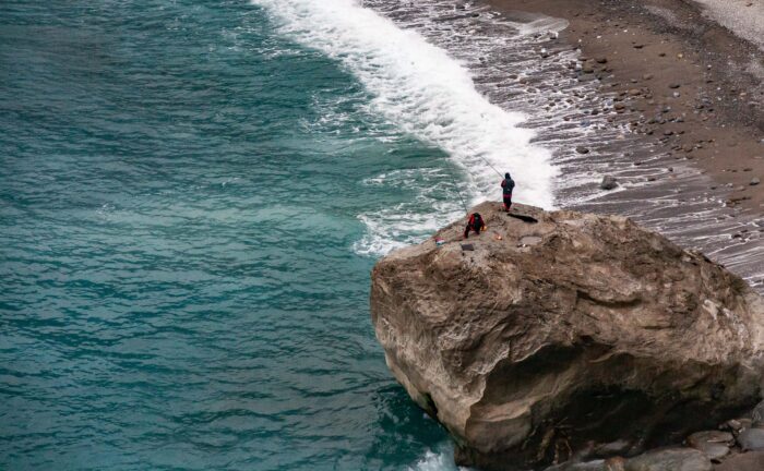 Taiwan, Y=Ilan County Prov, Cliffs Bay
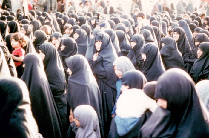 Iran, Women In Qom, 1984 - I walked across the road to see the Golden Temple of Qom, a very holy site in iran. But I was blocked in crossing the street again as an anti-American demonstration blocked my passage. They shouted "Marg bar America (Down with America)." The year was 1984, one of the worst for Iran-America relations.
 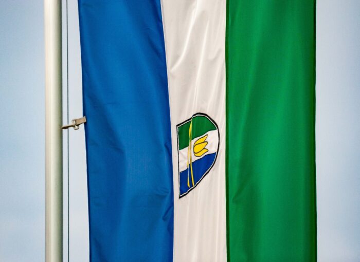 Slovenia, Dobrovnik Prov, Dobrovnik Obcina Flag
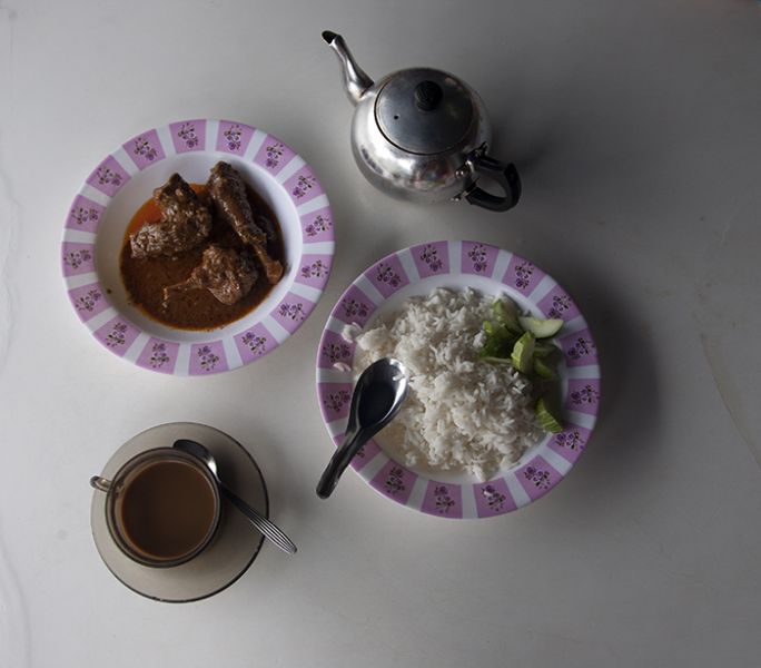 Thailand, Narathiwat Prov, Delicious Simple Meal
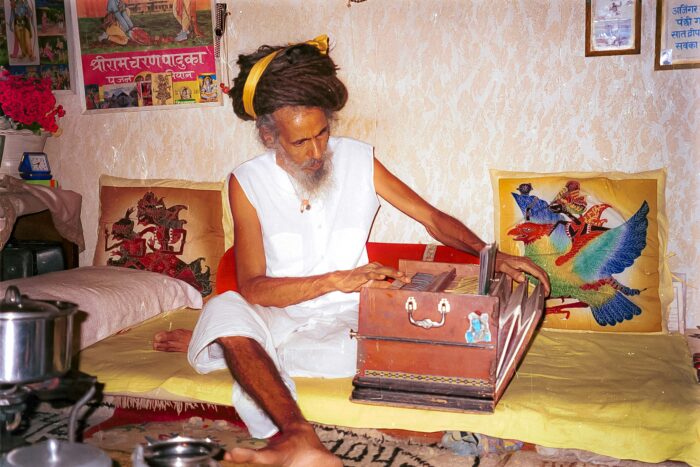 Nepal, Katmandu, Milk Baba, 1999 - Milk Baba was so named because he lives entirely on milk. No food passes his lips. He lives in a small room on the side of the stream at Pashiputinath, in the Katmandu greater city. He is one of the most memorable people I ever met. When he stood and let his hair down, it was longer than his body, falling to the floor and then some. He sat and began to play a hand organ. It was the most mellifluous melody I could imagine, combining beauty and mystery. He continued to play this for about ten minutes, and then, unexpectedly, he began to sing. The sound of his voice carried us away into another dimension. Being a good host, he asked us if we were wanted something to drink. Milk!!!
 Vietnam, An Giang Prov, Cook
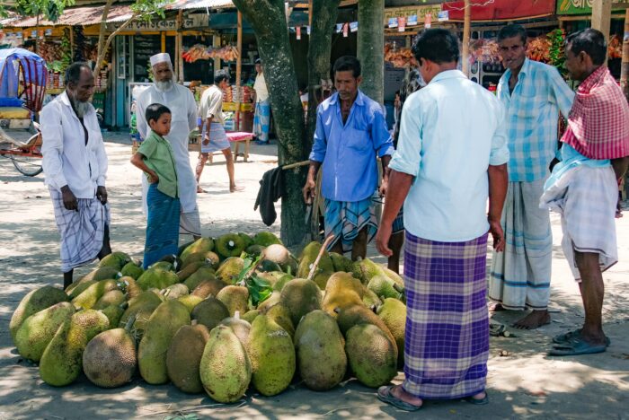 Bangladesh, Sylhet Prov, Street Market
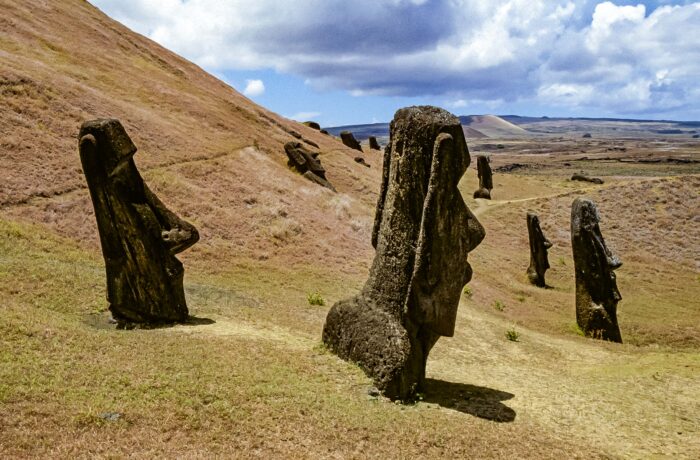 Easter Island, Buried Moai at Rano Raraku, 1997 - Most photographs one sees of Easter Island's Moai (stone scuptures) show a standing row of them. What was more incredible to me was Rano Raraku. In thiis Easter Island site, there are many Moai which have yet to be unearthed. What makes them amazing is that some, based on the size of the head sticking above the ground, are believed to be far taller than those which are standing. This photograph shows some of the heads sticking above the ground.