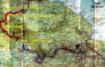
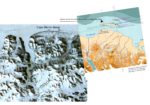
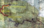
A Composite of a Satellite Image and Venezuelan Topographic Maps

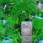
A Composite of a Satellite Image and Venezuelan Topographic Maps. Shows the route up the Ichúm River and far point reached in 2014. Jaguar Falls is marked north of far point reached.
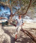
- Nation: Venezuela
- ISO Province:
- TCC Country: Venezuela
- Place:
- Year: 2013
- File name:
- Categories: From EPD
- Photo upload size: 2280×2280
- Photo display size:
More photos from
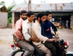
- Iran, Four Guys on Motorbike, 1984 - On my journe…
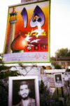
- Iran, Posters of Martyrs, 1984 - In 1984, Iran w…
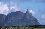
- Mauritius, Rock on Peak, 2002 - I was incredulous …
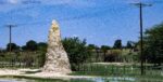
- Namibia, Termite Mound, 2000 - In Africa there a…
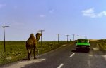
- Turkey, Camel Along Road, 1984 - For me as a Wes…
- Uganda, Elephant Sign, 1984 - I have only seen o…
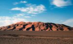
- Algeria, Sand Dunes, 1988 - I had heard of large s…

- Congo Zaire, Baboon On Riverboat, 1984 - I took t…

- Indonesia, Pulsating Rock Yellow, Pink, Red, Viole…
- Kazakhstan, Horse Rider, 1998 - On the way from St…
- Kazakhstan, Mausoleum City, 1998 - On the way acro…
- Kazakhstan, Sunset, 1998 - We camped out most nigh…
- Lesotho, Land Rover At River, 2000 - I drove nearl…
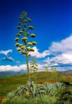
- Lesotho, Plant, 2001 - I thought this plant along …
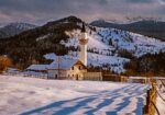
- Montenegro, Farm House, 2003 - I drove by myself f…
- Morocco, Morocco Across The Strait of Gibraltar, L…
- Papua New Guinea, Bamboo And Pandanus, 1983 - The …
- Papua New Guinea, Huli Feathers 2, 1983 - The Huli…
- Papua New Guinea, Jeff Shea With Huli Big Man, 198…
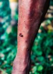
- Papua New Guinea, Leech On Leg, 1983 - This photog…
- Papua New Guinea, Map of Trek, 1983 - The loop at …
- Papua New Guinea, Tree Kangaroo, 1983 - Among the …
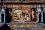
- Portugal, Tile Work, 1988 - I admired the tile wo…
- Solomon Islands, Tiny Frog, 1983 - I was amazed by…
- Somalia, Mogadishu Airstrip, Dallo Airliner, 2002 …

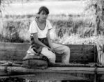
- Tanzania, Jeff Shea On Bus, 1984 - Gabrielle and I…
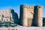
- Uzbekistan, Ancient Gate, 2002 - This ancient gate…
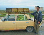
- Azerbaijan, Apples In Car, 2000 - This enterprisi…
- Congo Zaire, Barge Hits Land, 1984 - The river boa…
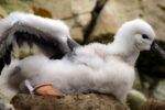
- Falkland Is, Black-browed Albatross Young, 2006 - …
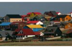
- Falkland Is, Houses, 2006 - I woke late and found …
- Falkland Is, Port Stanley, 2006 - On the way back …
- Iraq, Ancient Costumes, 2000 - These costumes on d…
- Niger, Niamey, Clothes Washer On Niger River, 1988…
- Pakistan, Forty-Eight Hour Bus Ride From Quetta To…
- Greenland, Warming Island, off coast of Liverpool …
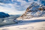
- Greenland, Warming Island, off coast of Liverpool …
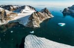
- Greenland, Warming Island, off coast of Liverpool …
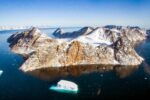
- Greenland, Warming Island, off coast of Liverpool …
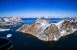
- Greenland, Warming Island, off coast of Liverpool …
- My diary entry of the day we visited the Tree of L…

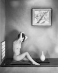
- Japan, Shoji, 1994 - This photograph was taken in …
- Slovenia, Scrap Metal, 2006 - There was a pile of …
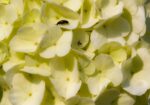
- Slovenia, Insect In Flowers, 2006 - A small bug ro…
- Japanese Inn, 1994, Japan…
- Romania, Farm Girl Sitting On Wagon, 1997 - On my …
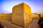
- Qatar, Old Fort, 2000 - …
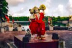
- Mauritius, God, 2003 - This statue is in a temple …
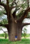
- Botswana, Baobab, 2001 - The Baobab tree is one of…
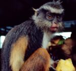
- Congo Zaire, Monkey on Riverboat, 1984 - This beau…
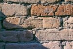
- Iraq, Ancient Bricks, 2002 - The ancient sites in …
- Kazakhstan, Jeff Shea On Tibet 98 Expedition, 1998…
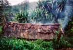
- Papua New Guinea, Hut, 1983 - The roof of this low…
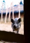
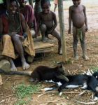
- Papua New Guinea, Pik, 1983 - The pig is a very va…
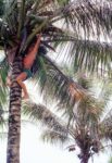
- Solomon Islands, Jeff Shea Getting Coconuts, 1983 …
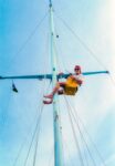
- Solomon Islands, Jeff Shea In The Bosun Chair, 198…
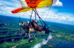
- Zambia, Microlite, 2000 - Taking a microlite over …
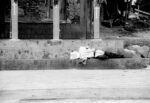
- Mexico, Sleeping On The Stairs, 1993 - It seemed s…
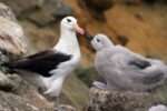
- Falkland Is, Black-browed Albatross Feeding Young,…

- Iraq, Barf Detergent, 2000 - One of the examples o…
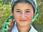
- Iraq, Portrait Of A Girl, 2000 - The young women i…
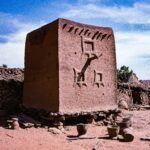
- Mali, Bankas, Dogon Hut 1, 1987 - I came upon thes…
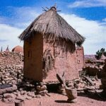
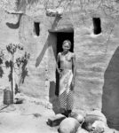
- Mali, Bankas, Dogon Hut 2, 1987 - This is the seco…
- Mali, Mopti Area, Bozo Girl, 1987 - When I was in …
- Greenland, Warming Island, off coast of Liverpool …
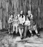
- Romania, Generations, 1997 - A few months before I…

- …
- Slovenia, Old Woman And Fire, 2006 - Lee McLaughli…
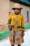
- Madagascar, Girl, 2003 - Madagascar was a wonderfu…

- Trinidad, Girls In Rain, 1997 - On one of my many …

- Trinidad, Woman With Stray Eye, 1993 - A woman sit…
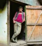
- Romania, Young Man In Doorway, 1997 - I walked acr…
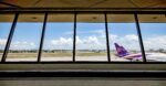
- PH, Manila, Airport, 2008, IMG_1670 - A photograph…
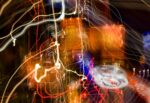
- PH, Manila Light Painting 1, 2008, IMG_2277 - A st…

- PH, Manila Light Painting 2, 2008, IMG_2275 - Real…

- …
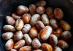
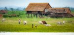
- Myanmar, Unknown Prov, Beans…
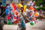
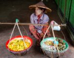
- Myanmar, Unknown Prov, Bicycle Vendor Scene…
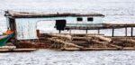
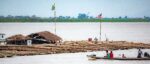
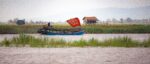
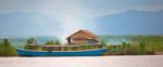
- Myanmar, Unknown Prov, Boat Detail…
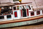
- Myanmar, Unknown Prov, Boat Detail…
- Myanmar, Unknown Prov, Boat Detail…
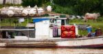
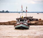
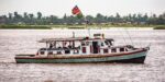
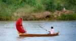
- Myanmar, Unknown Prov, Boat River…
- Myanmar, Unknown Prov, Boat River…
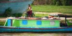
- Myanmar, Unknown Prov, Boat Scene…
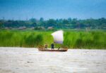
- Myanmar, Unknown Prov, Boat Scene…
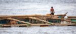
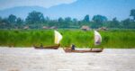
- Myanmar, Unknown Prov, Boat Scene…
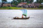
- Myanmar, Unknown Prov, Boat Scene…
- Myanmar, Unknown Prov, Boat Scene…
- Myanmar, Unknown Prov, Boat…
- Myanmar, Unknown Prov, Boats River…
- Myanmar, Unknown Prov, Temple Detail…
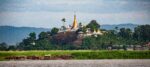
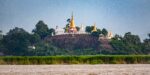
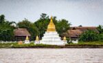
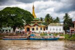
- Myanmar, Unknown Prov, Temple Near River…
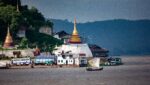
- Myanmar, Unknown Prov, Temple Near River…
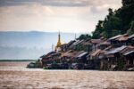
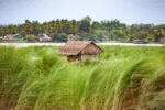
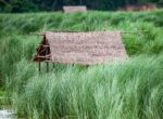
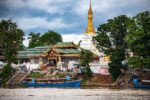
- Myanmar, Unknown Prov, Temple Village Near River…
- Myanmar, Unknown Prov, Temple Village Near River…
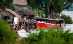
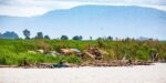
- Myanmar, Unknown Prov, Village People River Boats…
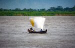
- Myanmar, Unknown Prov, Water Scene…
- Myanmar, Unknown Prov, Water Scene…
- Myanmar, Unknown Prov, Water Scene…
- Myanmar, Unknown Prov, Water Scene…
- Myanmar, Unknown Prov, Water Scene…
- Myanmar, Unknown Prov, Water Scene…
- Myanmar, Unknown Prov, Water Scene…
- Myanmar, Unknown Prov, Water Scene…

- Myanmar, Unknown Prov, Water Scene…
- Myanmar, Unknown Prov, Water Scene…
- Myanmar, Unknown Prov, Water Scene…
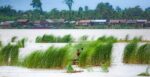
- Myanmar, Unknown Prov, Ayeyarwaddy River…
- Myanmar, Unknown Prov, Ayeyarwaddy River…
- Myanmar, Unknown Prov, Boat Vendor…
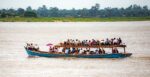
- Myanmar, Unknown Prov, Packed Boat…
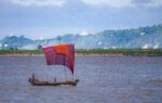
- Myanmar, Unknown Prov, Boat -…
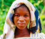
- Zimbabwe, Unknown Prov, Portrait Of Girl…
- …
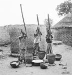
- Three Women Pounding Millet, 1987 Ivory Coast - 6…

- Lila…
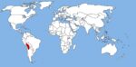
- World Map with the Altiplano shown in red Chile-Pe…
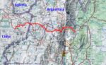
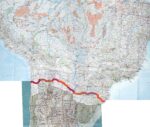
- Map of walk showing route from Socaire to Tilcara …
- Original Journal - “This is the last day...”…
- Original Journal - “If you should see...”…
- Original Journal - “Have a lot going for them...…

- Novita on Sun Baked Tiles, 1999 Anguilla - 8x10 fi…
- A Composite of a Satellite Image and Venezuelan To…
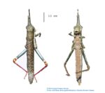
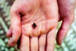
- Bactrophora Dominans, as collected in 2014. I col…
- Telly (José Luis Rodríguez Castillo) first point…
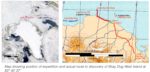
- Map of Previously Unmapped Land-like Features Nort…
- The Discovery of Stray Dog West, one of the World�…
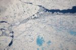
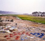
- Sea Ice, 2007 Arctic Ocean…
- Melting Sea Ice, 2007 Arctic Ocean For the ice t…
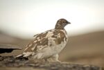
- Rock Ptarmigan [Lagopus mutus], 2007 North Greenla…

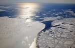
- Base Camp with Coast and Sea Ice, 2007 North Gree…
- Map of Northeast Portion of New Guinea My 39-day …
- Strickland Gorge, Oksapmin Side, 1983 Papua New G…
- Writing Love Letter to Judith While Floating In De…
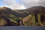
- Gough Island, 2006 South Atlantic, Gough Island…
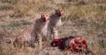
- Cheetahs Feeding on Wildebeest, 1984 Tanzania, Ngo…

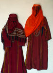
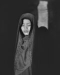
- Behind the Veil, 1999 8x10 film…
- Muslim Girl in Subdued Light, 2000 Saudi Arabia - …
- Sapa Girl, 2008 Vietnam, Sapa - 8x10 film…
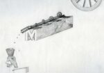
- The Alchemist, circa 1973 Jeff Shea - A drawing i…
- Hewa Hat, 1983 I made a crude sketch of the Hewa …
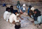
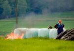
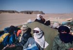
- Cooking Bread in the Sand – One Algeria, Sahara…
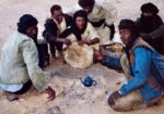
- Cooking Bread in the Sand – Two Algeria, Sahara…
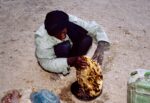
- Cooking Bread in the Sand – Three Algeria, Sahar…
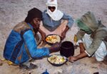
- Cooking Bread In The Sand – Four Algeria, Sahar…
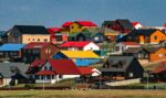
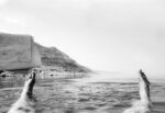
- Port Stanley Houses, 2006 Falkland Islands South A…
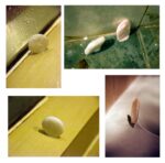
- Composite of Soaps that Landed Stuck on their Side…

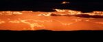
- Venus, 2013…
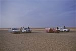
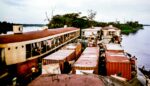
- Cars Being Brought from Europe to Niger for Sale, …
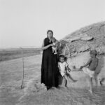
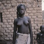
- Touareg Woman with Children, 1987 Mali, Mopti area…
- Bozo Girl with Braided Hair, 1987 Mali, Mopti area…
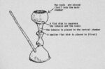
- Rajasthani Water Pipe, 1984 Illustration of Rajas…
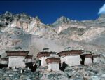
- Convent near Rongbuk Monastery, 1995 Tibet, near R…
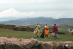
- Mount Ararat and Three Kurdish Women, 1984 Turkey …
- Riding on the Top of a Truck Hauling Dates to Nige…
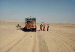
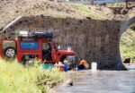
- The Truck Gets Stuck in the Sand, 1988 Algeria, S…

- In the Mirror, 2011…